

THESIS: BeniAtlas’
BeniAtlas’: An interface for the informal city
Abstract by Elisabeth van Overbeeke
A map is a chart or diagram that uses spatial relationships to communicate information. Through the medium of the map a desired goal can be impressed on people’s minds as a first step to changing the environment. The history of mapping shows that changes in technology brought about ideologies of progress that were communicated in maps. The digital revolution has brought about an image culture that is changing the way we connect with space. Instead of physical rules limiting the way we interact with space, we are now able to redefine it entirely. As architect Richard Wurman writes in the preface of The Exposed City, digital maps allow people “to see the things they’ve always seen but never seen,” and choose to respond to that new knowledge in space. Architects such as Richard Wurman, Buckminster Fuller, James Corner, Ole Bouman, Raoul Bunschoten and MVRDV, to name a few, have acknowledged the need to be involved in the design of digital mapping programs to maintain our position as advocates for high quality built space.
First and last stages in design of mapping framework
Digital mapping techniques are considered by many to be a tool of agency for marginalized people in the developing context. The last twenty years have seen a wave of “public participatory GIS (geographic information system)” programs being initiated in communities around the world. Digital maps offer the ability to store and represent an infinite amount of information, make it available to the masses, and apply techniques to make it dynamic and interactive. Beni Atlas explores mapping theory, analyses current employment of digital maps and then employs what is learned in the design for a mapping framework for the community of Beni in the eastern Democratic Republic of Congo in partnership with a local university.
The design uses a framework methodology because the image of a map is never alone but is surrounded by a set of community programs and digital sequences that drive how a map is created, used, shared, stored, connected, etc. This framework is the atlas’ (prime) that is taken to a new level of possibility with the use of digital technology. The goal of the framework is to unite data from bottom-up and top down sources, provide clarity and understanding for users, and become a tool that allows for communication and partnership between different actors in the community.
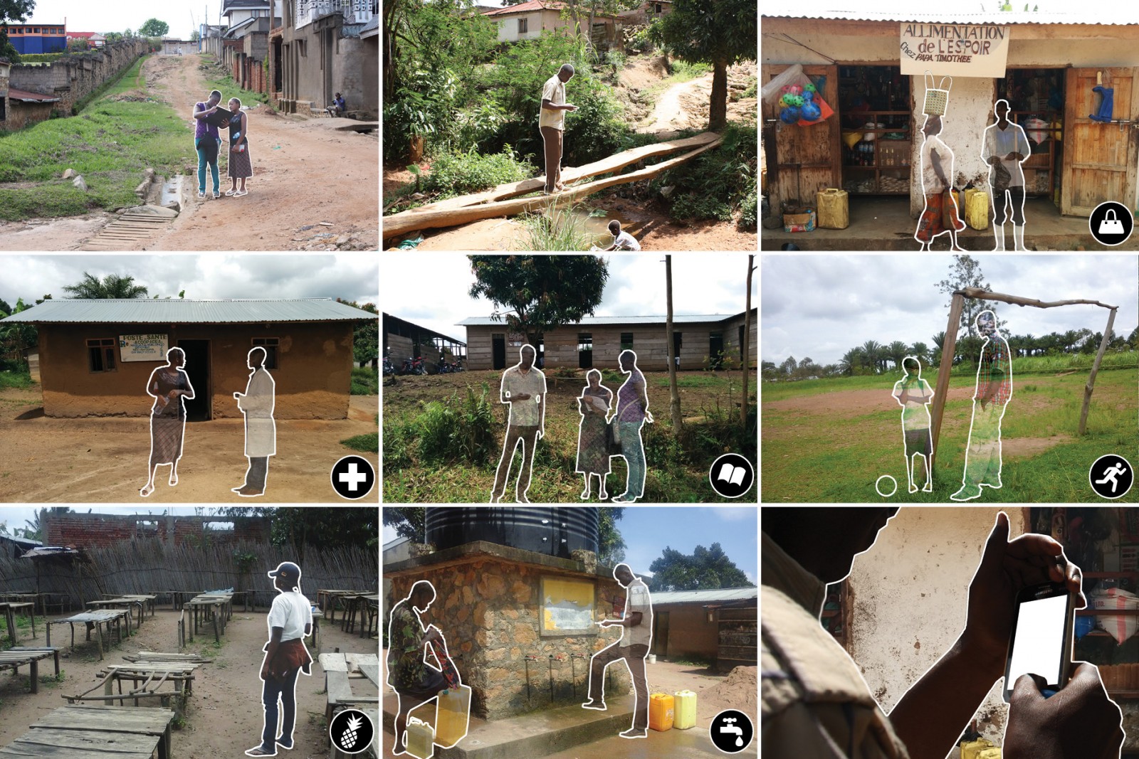
Implementation of first stage of the framework
The examining committee is as follows:
Supervisor: Maya Przybylski, University of Waterloo
Committee Members: Val Rynnimeri, University of Waterloo
Lola Sheppard, University of Waterloo
External Reader: Peter Johnson, University of Waterloo
The Defence Examination will take place on June 3, 2015 at 10:00 AM in the Lawrence Cummings Lecture Theatre.
Resulting base map of Beni
Experiments with beta mapping application


Leave a Reply